West Wicklow Bookshelf

~~ Over 500 Sources for West Wicklow History & Culture ~~

Archive for the category “Maps”

Mapping Our Mountains (2)

Cover image

© EastWest Mapping

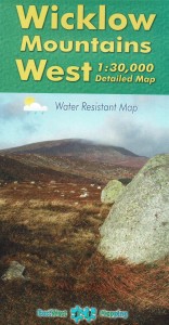
Full title: Lugnaquilla & Glendalough: 1:30,000 Detailed Map

Creator / Author: EastWest Mapping

Item Type / Page count: Map / 1 page folded down to 12 x 23cm

When Published: 2010 (updated in March 2013)

Publisher / Place of Publication: EastWest Mapping / Clonegal, Enniscorthy, Co. Wexford.

About: This detailed map covers the area from Woodenboley across to Lough Dan, down to Ballinaclash and over to Kiltegan. It has been compiled using satellite imagery combined with foot slogging, cycling and driving through the area and depicts in detail the network of tracks, paths, forests & hills of interest to walkers etc. Many historical sites are plotted and named and it provides an excellent panorama both for the rambler and armchair historian.

ID number(s): 9781899815319

Extra #1: Check Libraries Ireland for this publication.

Extra #2: Link to the Publisher’s website

A Nice County Map From 1901

© NUIG

Full title: Memorial atlas of Ireland: showing provinces, counties, baronies, parishes etc. in thirty-three double page maps. Compiled and drawn from the reliable official data and the latest information. Indexed.

Creator / Author: L.J. Richards & Company. Visualization designed by Kris Meen.

Item Type / Page count [1]: Book / 24pp plus 33 maps

Item Type / Page count [2]: Website / Publicly accessible

When Published: [1] 1901. [2] Digital visualization 2014.

Publisher / Place of Publication [1]: L.J. Richards & Company / 710 Provident Building, Philadelphia, U.S.A.

Publisher / Place of Publication [2]: James Hardiman Library, National University of Ireland, Galway / University Road, Galway.

About: This is a lovely collection of maps of every county in Ireland. Each has now been digitised to an extremely high standard and zooming in brings up features in great detail. These include boundaries for baronies and civil parishes. It is also possible to search under these headings or browse on a county-by-county basis. Please note that the image files are large and may take a little while to download.

ID number(s): None

Extra #1: Check Libraries Ireland for this publication.

Extra #2: Check OCLC WorldCat.org for this publication in libraries worldwide.

Extra #3: Link to the Memorial Atlas of Ireland via the James Hardiman Library, NUI Galway

Extra #4: Link to the individual map for County Wicklow from the Memorial Atlas of Ireland

Hat-Tip: To the James Hardiman Library, NUI Galway who have arranged for the digitisation of the Memorial Atlas of Ireland and its free accessibility online.

West Wicklow Panorama

Cover image

© Richard Chandler

Full title: The Fir Tree Aerial Map of the Wicklow Mountains & Foothills

Creator / Author: Richard Chandler.

Item Type / Page count: Map / 1 page folded down to 12.5 x 21cm

When Published: 2012

Publisher / Place of Publication: Richard Chandler / Fir Tree Cottage, St Marys, Chalford, Stroud, Gloucestershire, GL6 8PU England.

About: A map that gives a new perspective to the Wicklow Mountains and surrounding areas. It artistically interprets Ordnance Survey Mapping and aerial photography to provide a unique feel for the terrain that your ordinary map cannot convey. This map covers an area from Dublin City down to Coolgreany, across via Aughrim, Rathdangan and Grangecon, over to Narraghmore, onto Naas and back to Dublin. Unfortunately, coverage does not extend to Carnew, Shillelagh, Tinahely, Kiltegan or Baltinglass.

ID number(s): 9781899815285

Extra #1: Check Libraries Ireland for this publication.

Extra #2: Link to the Publisher’s website

Mapping Our Mountains (1)

Cover image

© EastWest Mapping

Full title: Wicklow Mountains West: 1:30,000 Detailed Map

Creator / Author: EastWest Mapping & Barry & Clive Dalby (Survey Team).

Item Type / Page count: Map / 1 page folded down to 12 x 23cm

When Published: 2010

Publisher / Place of Publication: EastWest Mapping / Clonegal, Enniscorthy, Co. Wexford.

About: This map takes in a major portion of the mountains located in the western half of the county. It has been compiled using satellite imagery combined with foot slogging, cycling and driving through the area. It includes many old placenames and historical sites and provides an excellent panorama both for the rambler and armchair historian. Lugnaquilla is not covered by this particular map, but is available as a separate publication.

ID number(s): 9781899815285

Extra #1: Check Libraries Ireland for this publication.

Extra #2: Link to the Publisher’s website

Post Navigation

American Ancestors Database News

all the news that's fit for genealogists

DNAeXplained - Genetic Genealogy

Discovering Your Ancestors - One Gene at a Time

West Wicklow Bookshelf

~~ Over 500 Sources for West Wicklow History & Culture ~~

An Irish Village

~~ Over 500 Sources for West Wicklow History & Culture ~~

Irish Election Literature

... what you maybe meant to keep...

Patrick Leigh Fermor

He drank from a different fountain

Ed Mooney Photography

The official blog of Ed Mooney Photography. Dad of 3, Photographer, Blogger, Powerlifter. Exploring the historical sites of Ireland.

Jacolette:

a gallery of Irish snapshot and vernacular photography.

IrishGenealogyNews

~~ Over 500 Sources for West Wicklow History & Culture ~~

Brand New Retro

Vintage Irish Pop Culture & Lifestyle

LPCover Lover

~~ Over 500 Sources for West Wicklow History & Culture ~~

Blog

~~ Over 500 Sources for West Wicklow History & Culture ~~