West Wicklow Bookshelf

~~ Over 500 Sources for West Wicklow History & Culture ~~

Archive for the tag “Deerpark”

Households in Blessington Parish in middle of 19th century

Book Cover image

Full title: Parish of Blessington

Creator / Author: Richard Griffith

Item Type / Page count: Book Chapter / eDoc / 11p

When Published: 1853

Publisher / Place of Publication: Alexander Thom and Sons for Her Majesty’s Stationary Office / 87 & 88 Abbey Street, Dublin.

Parent Publication [book]: County of Wicklow: valuation of the several tenements comprising that portion of the Union of Naas situate in the county above named / Richard Griffith, General Valuation Office / 27pp

About: The property tax system of 1850’s Ireland, otherwise known as Griffiths Valuation. It was the first major attempt at valuing property. This section lists householders in the Parish of Blessington in West Wicklow, part of the area covered by the Poor Law Union of Naas in Co. Kildare.

ID number(s): None

Contents: Ballydonnell North — Ballydonnell South – Ballylow – Ballynabrocky — Ballynascullogue Lower — Ballynascullogue Upper – Ballynatona — Ballysmuttan Lower — Ballysmuttan Upper — Ballyward – Blackrock – Blessington — Town of Blessington (Main Street) — Town of Blessington (Kilbride Road) — Blessington Demesne – Butterhill – Crosscoolharbour – Deerpark – Dillonsdown – Edmondstown – Haylands – Hempstown – Holyvalley — Knockieran Lower — Knockieran Upper — Lugnagun Great — Lugnagun Little – Newpaddocks – Oldcourt – Oldpaddocks – Rathnabo – Santryhill – Threecastles.

Extra #1: Read the entries for Griffiths Valuation Blessington Parish (pdf file).

Extra #2: Search Griffiths Valuation and link to contemporary maps at AskAboutIreland.ie

Extra #3: Check OCLC WorldCat.org for this publication in libraries worldwide

Households in Baltinglass Parish in middle of 19th century

Book cover image

Full title: Parish of Baltinglass

Creator / Author: Richard Griffith

Item Type / Page count: Book Chapter / eDoc / 15p

When Published: 1854

Publisher / Place of Publication: Alexander Thom and Sons for Her Majesty’s Stationary Office / 87 Abbey Street, Dublin.

Parent Publication [book]: County of Wicklow: valuation of the several tenements comprising that portion of the Union of Baltinglass situate in the county above named / Richard Griffith, General Valuation Office / 106pp

About: The property tax system of 1850’s Ireland, otherwise known as Griffiths Valuation. It was the first major attempt at valuing property. This section lists householders in the Parish of Baltinglass, part of the area covered by the Poor Law Union of Baltinglass in West Wicklow.

ID number(s): None

Contents: Baltinglass East — Town of Baltinglass – Main Street – Weaver’s Square – Chapel Hill – Church Street — Baltinglass West – Mill Street – Ballitore Road – Belan Street – Tullow Old Road – Edward Street — Bawnoge – Boley – Boleylug – Carsrock – Cloghcastle – Clogh Lower – Clogh Upper – Coolinarrig Lower – Coolinarrig Upper – Deerpark – Holdenstown Lower – Holdenstown Upper – Irongrange Lower – Irongrange Upper – Kilmurry – Kilmurry Lower – Kilmurry Upper — Lathaleere – Newtownsaunders – Pinnacle – Slaney Park – Sruhaun – Stratford Lodge – Woodfield – Woodfieldglen — Rathmoon.

Extra #1: Read the entries for Griffiths Valuation Baltinglass Parish (pdf file). The entries for Baltinglass commence at the bottom of the first page.

Extra #2: Search Griffiths Valuation and link to contemporary maps at AskAboutIreland.ie

Extra #3: Check Libraries Ireland for this publication.

Extra #4: Check OCLC WorldCat.org for this publication in libraries worldwide

Census of Donaghmore

National Archives Logo


Full title: Townlands / Streets in Donaghmore (Wicklow)

Creator / Author: National Archives of Ireland

Item Type: Website / Publicly Accessible

Homepage  URL: http://www.census.nationalarchives.ie/

When Viewed: Contents correct as of May 2014.

Publisher / Place of Publication: National Archives of Ireland / Bishop Street, Dublin 8.

About: The Census returns for the Donaghmore District Electoral Division arranged alphabetically by townland. The 1901 census was taken on 31st March 1901. The 1911 census was taken on 2nd April 1911.

Contents: Ballintruer Beg — Ballintruer More — Ballyhubbock Lower — Ballyhubbock Upper — Brusselstown — Castlequarter — Castleruddery Lower — Castleruddery Upper — Castlesallagh — Coolamaddra — Deerpark — Donaghmore — Killybeg — Newtown — Raheen — Randalstown — Whitestown Lower — Whitestown Upper.

Extra #1: Browse the 1901 Census for Donaghmore DED

Extra #2: Browse the 1911 Census for Donaghmore DED

Tithes Payable by Blessington Folk from 1833

Full title: Townlands in Blessington (Wicklow)

Creator / Author: Genealogical Society of Utah in partnership with The National Archives of Ireland

Item Type: Website / Publicly Accessible

Homepage URL: http://titheapplotmentbooks.nationalarchives.ie/search/tab/home.jsp

When Viewed: Contents described are those showing when viewed in February 2014.

Publisher / Place of Publication: National Archives of Ireland / Bishop Street, Dublin 8.

About: Tithe Applotment Books were compiled between 1823 and 1837 in an attempt to determine how much the holders of agricultural land over 1 acre should pay in taxes or tithes to the established Church of Ireland. These books list the name of the head of each relevant household outside of urban areas. A Tithe Applotment book was compiled for each Church of Ireland parish. Some of the transcribed names of people and places are not 100% accurate, but the original entries may be viewed for clarification.

Contents: Ballydonnell – Ballylow – Ballynabrocky – Ballynatona – Ballynasculloge – Ballyward – Blackrock – Blessington — Blessington Demesne – Burgage – Burgage More – Burgage Moyle – Burgage Moyle Glashina – Burgage Moyle Russellstown – Butterhill – Crosscoolharbour – Deerpark – Dillonsdown – Edmondstown – Glashina — Haylands – Hempstown – Holyvalley – Lower Ballynasculloge — Lower Ballysmuttan — Lower Knockieran – Lugnagun — Merry Land – Oldcourt – Paddocks – Russborough – Russellstown – Santryhill — Threecastles and Goldenhill – Threecastles — Upper Ballynasculloge — Upper Ballysmuttan — Upper Knockieran.

Extra #1: Browse the Tithe Applotment Book(s) for Blessington Parish

Hat-Tip: To the Genealogical Society of Utah and The National Archives of Ireland who have arranged for the digitisation of these records and their free accessibility online.

Census of Baltinglass

National Archives logo

Full title: Townlands / Streets in Baltinglass (Wicklow)

Creator / Author: National Archives of Ireland

Item Type: Website / Publicly Accessible

Homepage  URL: http://www.census.nationalarchives.ie/

When Viewed: Contents correct as of December 2013.

Publisher / Place of Publication: National Archives of Ireland / Bishop Street, Dublin 8.

About: The Census returns for the Baltinglass District Electoral Division arranged alphabetically by townland. The 1901 census was taken on 31st March 1901. The 1911 census was taken on 2nd April 1911.

Contents: Baltinglass East — Baltinglass East Town — Baltinglass West –Bawnoge — Carsrock — Clogh Lower — Clogh Upper — Cloghcastle — Deerpark — Holdenstown Lower — Holdenstown Upper — Irongrange Lower — Irongrange Upper — Lathaleere — Newtownsaunders — Raheen — Rampere — Rathmoon — Sruhaun — Stratfordlodge.

Extra #1: Browse the 1901 Census for Baltinglass DED

Extra #2: Browse the 1911 Census for Baltinglass DED

Households in Kiltegan Parish in middle of 19th century

Book cover image

Full title: Parish of Kiltegan

Creator / Author: Richard Griffith

Item Type / Page count: Book Chapters / eDocs /20p (16p + 4p)

When Published: 1854

Publisher / Place of Publication: Alexander Thom and Sons for Her Majesty’s Stationary Office / 87 Abbey Street, Dublin.

Parent Publication [book]: County of Wicklow: valuation of the several tenements comprising that portion of the Union of Baltinglass situate in the county above named / Richard Griffith, General Valuation Office / 106pp

About: The property tax system of 1850’s Ireland, otherwise known as Griffiths Valuation. It was the first major attempt at valuing property. This section lists householders in the Parish of Kiltegan, part of the area covered by the Poor Law Union of Baltinglass in West Wicklow. The parish of Kiltegan takes in parts of the Baronies of both Ballinacor South and  Upper Talbotstown.

ID number(s): None

Contents: [Parish of Kiltegan within Barony of Ballinacor South] Ballinguile — Ballinguile Hill — Carrigatheme — Knocknagree — Lybagh — Rathcoyle Lower — Rathcoyle Upper — Slieveboy Lower — Slieveboy Upper — Slievemaan — Slievenamough — Slievenamough Plain — Toorboy.

Contents:  [Parish of Kiltegan within Barony of Upper Talbotstown] Ballybrackbeg — Ballybrackmore — Ballykillmurry — Ballyknockan — Ballymaconey — Bawnogue — Bernagh — Borkillbeg — Borkillmore — Carrig Lower — Carrig Mountain — Carrig Upper — Cornan East — Cornan West — Cranareen — Crossnacole — Danesfort Lower — Danesfort Upper — Deerpark — Drim — Fiddan — Fiddancoyle — Graigue — Highpark Lower — Highpark Upper — Humewood — Kelsha — Kelshabeg — Killamoat Lower — Killamoat Upper — Kiltegan — Village of Kiltegan — Knockavurrig — Muckduff Lower — Muckduff Upper — Mullannacranna — Rathdangan — Rathduffbeg — Rathgorragh Lower — Rathgorragh Upper  — Slievereagh Lower — Slievereagh Upper.

Extra #1: Read the entries for  Griffiths Valuation Kiltegan Parish (pdf file).

Extra #2: Search Griffiths Valuation and link to contemporary maps at AskAboutIreland.ie

Extra #3: Check Libraries Ireland for this publication.

Extra #4: Check OCLC WorldCat.org for this publication in libraries worldwide
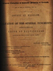
Households in Donaghmore Parish in middle of 19th century

Book cover image

Full title: Parish of Donaghmore

Creator / Author: Richard Griffith

Item Type / Page count: Book Chapter / eDoc / 16p

When Published: 1854

Publisher / Place of Publication: Alexander Thom and Sons for Her Majesty’s Stationary Office / 87 Abbey Street, Dublin.

Parent Publication [book]: County of Wicklow: valuation of the several tenements comprising that portion of the Union of Baltinglass situate in the county above named / Richard Griffith, General Valuation Office / 106pp

About: The property tax system of 1850’s Ireland, otherwise known as Griffiths Valuation. It was the first major attempt at valuing property. This section lists householders in the Parish of Donaghmore, part of the area covered by the Poor Law Union of Baltinglass in West Wicklow.

ID number(s): None

Contents: Ballinabarny — Ballinabarny Gap — Ballinard — Ballinclea — Ballineddin Lower — Ballineddin Mountain — Ballineddin Upper — Ballinfoyle Lower — Ballinfoyle Upper — Ballintruerbeg — Ballintruermore — Ballyhubbock Lower — Ballyhubbock Upper — Ballyreask Ballytoole Lower — Ballytoole Upper — Ballyvoghan — Ballyvraghan — Blackpits — Blane — Brittas — Brusselstown — Bushfield — Camera — Camerahill North — Camerahill South — Cannow — Cannow Mountain — Castlequarter — Castleruddery Lower — Castleruddery Upper — Castlesallagh — Clonshannon — Clornagh — Coan — Colliga — Coolamaddra — Coolmoney — Crissadaun — Davidstown — Deerpark — Derrynamuck — Donaghmore — Drumreagh — Eadestown Hill — Eadestown Middle — Eadestown North — Eadestown South — Fauna — Gibstown — Kelashmore — Kilbreffy — Killybeg — Knickeen — Knockanarrigan — Knockandarragh — Knockaderry — Knockamunnion — Leitrim — Leoh — Levern — Lobawn — Lugnaquillia — Monroe — Moorspark — Moorstown — Newpark — Newtown — Pollaghadoo — Raheen — Randalstown — Rostyduff Lower — Rostyduff Upper — Seskin — Snugborough — Spinans, East — Spinans Hill — Spinans, Middle — Spinans, West — Stranahely — Sugarloaf — Table Mountain — Tinnahinch — Whitestown Lower — Whitestown Upper.

Extra #1: Read the entries for  Griffiths Valuation Donaghmore Parish (pdf file).

Extra #2: Search Griffiths Valuation and link to contemporary maps at AskAboutIreland.ie

Extra #3: Check Libraries Ireland for this publication.

Extra #4: Check OCLC WorldCat.org for this publication in libraries worldwide

Census of Blessington

National Archives logo

Full title: Townlands / Streets in Blessington (Wicklow)

Creator / Author: National Archives of Ireland

Item Type: Website / Publicly Accessible

Homepage  URL: http://www.census.nationalarchives.ie/

When Viewed: Contents correct as of December 2012.

Publisher / Place of Publication: National Archives of Ireland / Bishop Street, Dublin 8.

About: The Census returns for the Blessington District Electoral Division arranged alphabetically by townland. The 1901 census was taken on 31st March 1901. The 1911 census was taken on 2nd April 1911.

Contents: Ballydonnell — Ballylow — Ballynabrocky — Ballynasculloge — Ballynatona — Ballysmutton / Ballysmuttan — Ballyward — Blackrock — Blessington — Blessington Demesne — Blessington Town — Butterhill — Crosscoolharbour — Deerpark — Dillonsdown — Edmondstown — Haylands — Hempstown — Knockieran — Lugnagun — Oldcourt — Oldpaddocks — Rathnabo — Santryhill — Threecastles.

Extra #1: Browse the 1901 Census for Blessington DED

Extra #2: Browse the 1911 Census for Blessingon DED

Visitor’s Guide to Historic Sites

Book cover image

© The Publishers

Full title: A Guide to the Archaeology of County Wicklow

Creator / Author: Eoin Grogan and Tom Hillery

Item Type / Page count: Book / 59p

When Published: 1993

Publisher / Place of Publication: Wicklow County Tourism / County Buildings, Wicklow.

About: Wicklow has a wealth of archaeological sites and ancient monuments. This A4 size publication aims to interest the tourist in this aspect of our heritage. Many West Wicklow sites are included in this excellent and profusely illustrated introduction to the archaeology of Wicklow.

ID number(s): 0951975404

Chapters: The Neolithic: Passage tombs — Late Neolithic burial sites — Wedge tombs — The Early Bronze Age: Ceremonial circles — The Iron Age: hillforts — The Early Medieval Period: Ringforts — Glendalough — Bullauns, graveslabs and ogham stones — Early and later medieval churches — Viking and medieval towns — The Later Medieval Period: Monastic sites — Mottes, moated sites and castles — Anglo-Norman fortifications — Tower houses — Castles — Places of special interest — Archaeological trails — Suggested reading — Glossary — List of sites by townland — List of figures.

Extra #1: Contains plans of all the major sites, drawn by Sarah Cross

Extra #2: Check Libraries Ireland for this publication.

Extra #3: Check OCLC WorldCat.org for this publication in libraries worldwide.

Post Navigation

American Ancestors Database News

all the news that's fit for genealogists

DNAeXplained - Genetic Genealogy

Discovering Your Ancestors - One Gene at a Time

West Wicklow Bookshelf

~~ Over 500 Sources for West Wicklow History & Culture ~~

An Irish Village

~~ Over 500 Sources for West Wicklow History & Culture ~~

Irish Election Literature

... what you maybe meant to keep...

Patrick Leigh Fermor

He drank from a different fountain

Ed Mooney Photography

The official blog of Ed Mooney Photography. Dad of 3, Photographer, Blogger, Powerlifter. Exploring the historical sites of Ireland.

Jacolette:

a gallery of Irish snapshot and vernacular photography.

IrishGenealogyNews

~~ Over 500 Sources for West Wicklow History & Culture ~~

Brand New Retro

Vintage Irish Pop Culture & Lifestyle

LPCover Lover

~~ Over 500 Sources for West Wicklow History & Culture ~~

Blog

~~ Over 500 Sources for West Wicklow History & Culture ~~