West Wicklow Bookshelf

~~ Over 500 Sources for West Wicklow History & Culture ~~

Archive for the tag “Keadeen”

Avenues to an Afterlife?

© The Publisher & The Author

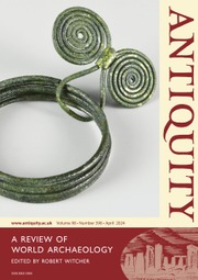
Full title: Exploring the Baltinglass cursus complex: routes for the dead

Creator / Author: James O’Driscoll

Item Type / Page count: Journal Article (online) / 18p

Journal Information: Antiquity First View, pp. 1-18

When Published: 25th April 2024

Publisher / Place of Publication: Cambridge University Press on behalf of Antiquity Publications Ltd. / Cambridge, CB2 8AE, United Kingdom

About: James O’Driscoll, who has spent the past number of years investigating the Baltinglass Hillfort Complex, now presents his latest findings in an online article under the aegis of the scholarly journal ‘Antiquity’. The author describes a cluster of cursus monuments that have been discovered using the newest archaeology tools and techniques. This is the first time that a cluster of such monuments has been discoved in Ireland. The author concludes that the monuments “demonstrate a clear connection between the dead, major solar events and seasonal farming cycles”.

ID number(s): 0003-598X (Print), 1745-1744 (Online)

Article Contents: Abstract — Introduction — Neolithic Ireland and the Baltinglass Landscape — The Baltinglass Cursus Monuments — The Baltinglass Cursus Monuments in Context — Routes for the Dead? — Conclusion — Funding Statement — References.

Extra #1: includes maps and photographs.

Extra #2: Read this article online via the Publisher’s Website.

Extra #3: Link to the website of the journal ‘Antiquity’ at: https://antiquity.ac.uk/

Extra #4: The findings of James O’Driscoll in the above article have been picked up by a number of news outlets and social media streams. For example, ‘Newsweek’ (online edition) contains this item by Aristos Georgiou.

Twenty-Four Grand Days Out

© The Publisher

Full title: Hill Walkers Wicklow

Creator / Author: David Herman

Item Type / Page count: Book / 72p

When Published: March 1989

Publisher / Place of Publication: Shanksmare Publications / Not stated

About: This book details 24 one-day walking routes covering all parts of the Wicklow Mountains. First published in 1989, it has proved to be very popular with walkers and it has run through many editions. The number of routes in later editions has increased up to 30.

ID number(s): 0951454706 / 0953143317 / 0951454757

Contents: Introduction – The Routes: (1) The Tallaght Hills and Seefingan – (2) Circuit of Glencree – (3) The Dublin Hills – (4) Calary and Djouce to Enniskerry – (5) The North-East Fringe – (6) Glencree to Djouce – (7) Kippure and the Upper Liffey Valley – (8) Circuit of Glenbride – (9) Sally Gap to Mullaghcleevaun East Top – (10) Lugnagun, Black Hill and Mullaghacleevaun – (11) Lough Tay, Lough Dan and Scarr – (12) The Barnacullian Ridge and Tonelagee – (13) Circuit of Glenmacnass – (14) The Fair Mountain and Lough Firrib – (15) South of the King’s River – (16) Circuit of Glendalough – (17) Church Mountain and the Glen of Imaal – (18) Lugnaquilla from Glenmalure – (19) Carrawaystick and  Croaghan Moira – (20) Circuit of Glen Ow – (21) Keadeen and Slievemann – (22) The Upper Glen of Imaal – (23) Rathdrum to Glendalough – (24) Croaghan Kinsella – Eight Days in the Mountains – Bibliography – Useful addresses.

WW Connection #1: Many of the routes described in the book are located in West Wicklow.

Extra #1: Includes sketch maps of every route.

Extra #2: Check Libraries Ireland for this publication.

Extra #3: Check OCLC WorldCat.org for this publication in libraries worldwide.

Atop Twin Peaks

Cover image

© The Publisher
(image Gareth McCormack)

Full title: Keadeen and Carrig

Creator / Author: David Herman, photos by Eoin Clarke

Item Type / Page count: Magazine Article / 3p

Journal Information: Walking World Ireland, Issue 57, pp. 20-22

When Published: Sept / Oct 2003

Publisher / Place of Publication: Athletic Promotions Ltd / Cherrywood House, Garville Drive, Garville Avenue, Rathgar, Dublin 6.

About: A short article which guides the walker to the top of the twin peaks of Keadeen and Carrig in West Wicklow. One feature of the walk is that the peaks “offer fine views of the plains of Kildare”.

ID number(s): 0791-8801

Extra #1: Check OCLC WorldCat.org for this publication in libraries worldwide.

Extra #2: Includes map and three colour photographs.

Mapping Our Mountains (2)

Cover image

© EastWest Mapping

Full title: Lugnaquilla & Glendalough: 1:30,000 Detailed Map

Creator / Author: EastWest Mapping

Item Type / Page count: Map / 1 page folded down to 12 x 23cm

When Published: 2010 (updated in March 2013)

Publisher / Place of Publication: EastWest Mapping / Clonegal, Enniscorthy, Co. Wexford.

About: This detailed map covers the area from Woodenboley across to Lough Dan, down to Ballinaclash and over to Kiltegan. It has been compiled using satellite imagery combined with foot slogging, cycling and driving through the area and depicts in detail the network of tracks, paths, forests & hills of interest to walkers etc. Many historical sites are plotted and named and it provides an excellent panorama both for the rambler and armchair historian.

ID number(s): 9781899815319

Extra #1: Check Libraries Ireland for this publication.

Extra #2: Link to the Publisher’s website

Banks Our Ancestors Built

Cover image

© JSTOR

Full title: Some Cursus Monuments in South Leinster

Creator / Author: Chris Corlett

Item Type / Page count: Journal Article / 6p

Journal Information: Archaeology Ireland, Vol. 28, No. 2, pp. 20-25

When Published: Summer 2014

Publisher / Place of Publication: Wordwell Ltd. / Unit 9, 78 Furze Road, Sandyford, Dublin 18.

About: A cursus is a prehistoric construction consisting of two banks parallel to each other. They can extend for some considerable distances. Their function is not clear, although they appear to be associated with other nearby prehistoric features. This article looks at four cursuses in the South Leinster area, two of which are in West Wicklow, one which is just over the border in East Kildare and one in South Carlow.

ID number(s): 0790-892X

Extra #1: includes several colour photographs.

Extra #2: Check OCLC WorldCat.org for this publication in libraries worldwide.

Extra #3: Read this article online via JSTOR. [Personal registration / conditions apply]. Alternatively, your local public library may provide free online access to this article.

Extra #4: Visit the author’s website & blog

Extra #5: Link to the author’s page on Academia.edu

Tithes Payable by Kilranelagh Folk from 1825


Full title: Townlands in Kilranelagh (Wicklow)

Creator / Author: Genealogical Society of Utah in partnership with The National Archives of Ireland

Item Type: Website / Publicly Accessible

Homepage URL: http://titheapplotmentbooks.nationalarchives.ie/search/tab/home.jsp

When Viewed: Contents described are those showing when viewed in September 2014.

Publisher / Place of Publication: National Archives of Ireland / Bishop Street, Dublin 8.

About: Tithe Applotment Books were compiled between 1823 and 1837 in an attempt to determine how much the holders of agricultural land over 1 acre should pay in taxes or tithes to the established Church of Ireland. These books list the name of the head of each relevant household outside of urban areas. A Tithe Applotment book was compiled for each Church of Ireland parish. Some of the transcribed names of people and places are not 100% accurate, but the original entries may be viewed for clarification.

Contents: Ballinroan — Boleycarrigeen — Barraderry — Cloghnagaune — Colvinstown — Downings — Englishtown — Fortgranite — Keadeen — Killalish — Kilranelagh — Mr Green’s Estate — North Barraderry — South Barraderry — Talbotstown

Extra #1: Browse the Tithe Applotment Book(s) for Kilranelagh Parish

Hat-Tip: To the Genealogical Society of Utah and The National Archives of Ireland who have arranged for the digitisation of these records and their free accessibility online

Households in Kilranelagh Parish in middle of 19th century

Book cover image

Full title: Parish of Kilranelagh

Creator / Author: Richard Griffith

Item Type / Page count: Book Chapter / eDoc / 6p

When Published: 1854

Publisher / Place of Publication: Alexander Thom and Sons for Her Majesty’s Stationary Office / 87 Abbey Street, Dublin.

Parent Publication [book]: County of Wicklow: valuation of the several tenements comprising that portion of the Union of Baltinglass situate in the county above named / Richard Griffith, General Valuation Office / 106pp

About: The property tax system of 1850’s Ireland, otherwise known as Griffiths Valuation. It was the first major attempt at valuing property. This section lists householders in the Parish of Kilranelagh, part of the area covered by the Poor Law Union of Baltinglass in West Wicklow.

ID number(s): None

Contents: Ballinroan Lower — Ballinroan Upper — Barraderry East — Barraderry North — Barraderry West — Boleycarrigeen — Brockna — Cloughnagaune — Colvinstown Lower — Colvinstown Upper — Downings — Englishtown — Fortgranite — Keadeen — Killalish Lower — Killalish Upper — Kilranelagh — Newtown — Talbotstown Lower — Talbotstown Upper.

Extra #1: Read the entries for  Griffiths Valuation Kilranelagh Parish (pdf file).

Extra #2: Search Griffiths Valuation and link to contemporary maps at AskAboutIreland.ie

Extra #3: Check Libraries Ireland for this publication.

Extra #4: Check OCLC WorldCat.org for this publication in libraries worldwide

Ancient Keadeen Kibbutz?

Cover image

© JRSAI

Full title: A Prehistoric Enclosure at Keadeen, Co. Wicklow

Creator / Author: Christiaan Corlett

Item Type / Page count: Journal Article / 11pp

Journal Information: Journal of The Royal Society of Antiquaries of Ireland, Volume 134, pp. 80-90

When Published: 2004

Publisher / Place of Publication: R.S.A.I / Merrion Square, Dublin

About: The article is a detailed description of the visible remains of an archaeological site which encloses several hut sites and a standing stone. The site is compared with hillforts in the area although it differs from these in that it is not located at the summit. A site excavation will be needed to try to answer questions about its origin and use.

ID number(s): 0035-9106

Extra #1: Includes 10 black & white photographs and a plan of the site.

Extra #2: Check Libraries Ireland for this publication.

Extra #3: Check OCLC WorldCat.org for this publication in libraries worldwide.

Extra #4: Read this article online via JSTOR. [Personal registration / conditions apply]. Alternatively, your local public library may provide free online access to this article.

Extra #5: Visit the author’s website & blog

Extra #6: Link to the author’s online presence on Academia.edu

Census of Eadestown

National Archives logo

Full title: Townlands / Streets in Eadestown (Wicklow)

Creator / Author: National Archives of Ireland

Item Type: Website / Publicly Accessible

Homepage  URL: http://www.census.nationalarchives.ie/

When Viewed: Contents correct as of September 2013.

Publisher / Place of Publication: National Archives of Ireland / Bishop Street, Dublin 8.

About: The Census returns for the Eadestown District Electoral Division arranged alphabetically by townland. The 1901 census was taken on 31st March 1901. The 1911 census was taken on 2nd April 1911.

Contents: Ballinroan Lower — Ballinroan Upper — Boley — Boleycarrigeen — Boleylug — Cloghnagaune — Colvinstown Lower — Colvinstown Upper (1901 only) — Coolinarrig Lower — Coolinarrig Upper — Downings — Eadestown Hill — Eadestown North — Eadestown South — Keadeen — Kill — Kilranelagh — Moorstown — Spinans East — Spinans Middle — Spinans West —

Extra #1: Browse the 1901 Census for Eadestown DED

Extra #2: Browse the 1911 Census for Eadestown DED

Post Navigation

American Ancestors Database News

all the news that's fit for genealogists

DNAeXplained - Genetic Genealogy

Discovering Your Ancestors - One Gene at a Time

West Wicklow Bookshelf

~~ Over 500 Sources for West Wicklow History & Culture ~~

An Irish Village

~~ Over 500 Sources for West Wicklow History & Culture ~~

Irish Election Literature

... what you maybe meant to keep...

Patrick Leigh Fermor

He drank from a different fountain

Ed Mooney Photography

The official blog of Ed Mooney Photography. Dad of 3, Photographer, Blogger, Powerlifter. Exploring the historical sites of Ireland.

Jacolette:

a gallery of Irish snapshot and vernacular photography.

IrishGenealogyNews

~~ Over 500 Sources for West Wicklow History & Culture ~~

Brand New Retro

Vintage Irish Pop Culture & Lifestyle

LPCover Lover

~~ Over 500 Sources for West Wicklow History & Culture ~~

Blog

~~ Over 500 Sources for West Wicklow History & Culture ~~